3D Earthworks Modelling
Built for Real World Performance
We create high-accuracy, Trimble-ready 3D earthworks models for civil contractors who need millimetre precision and flawless on-site execution.
Why Precision Earth Modelling
At Precision Earth Modelling, we combine advanced 3D modelling expertise with real-world machine control experience, so that you get to use surfaces that perform exactly as intended on Trimble Earthworks machines.
Machine-Ready Files
Delivered in formats optimised for Trimble Earthworks — no conversion issues, no surprises.
Contractor Focused
Created by experienced civil operators who understand what actually works on the ground.
Fast Turnaround
Quick, reliable delivery so your projects stay on schedule.
Our Services
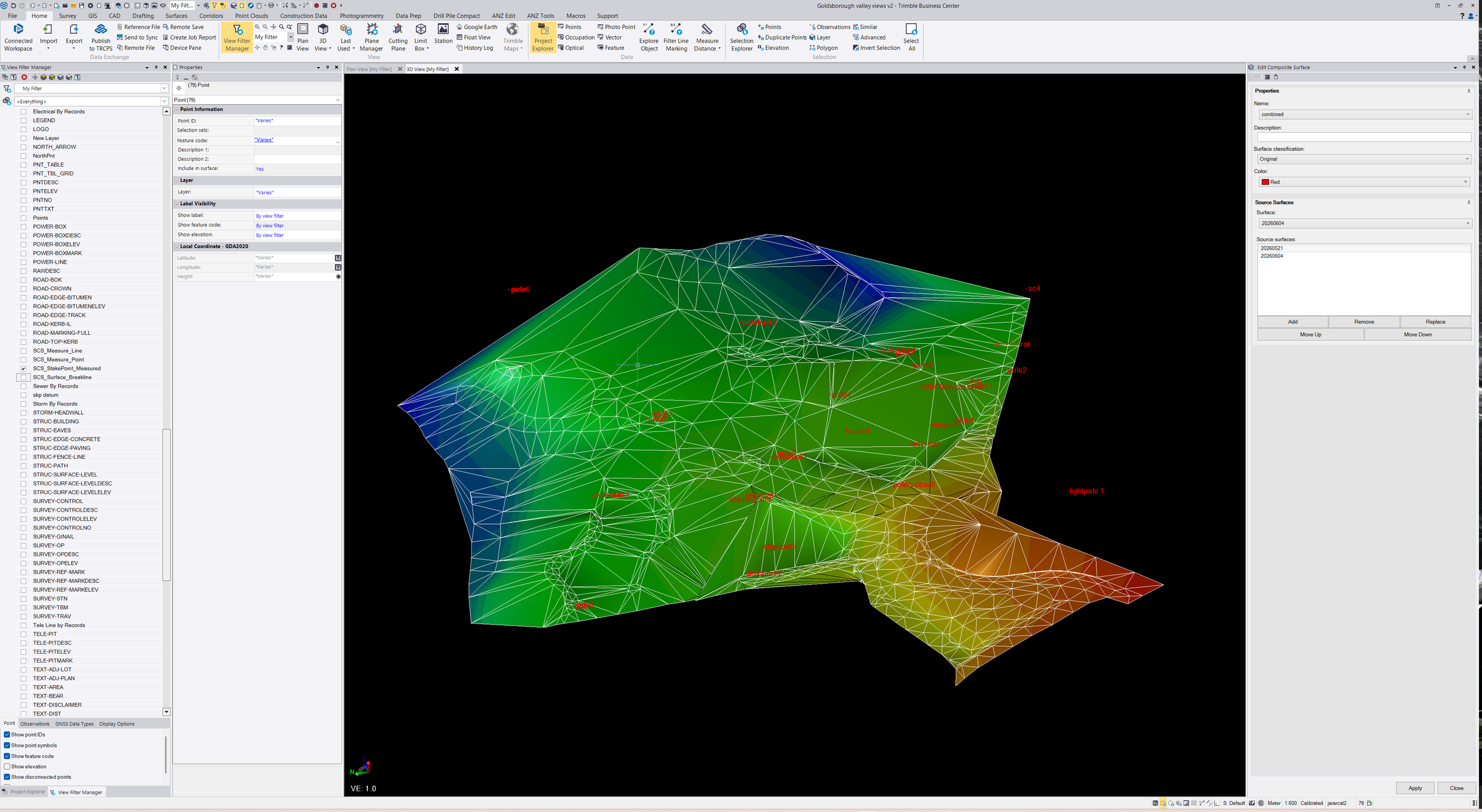
Trimble-Ready Surface Modelling
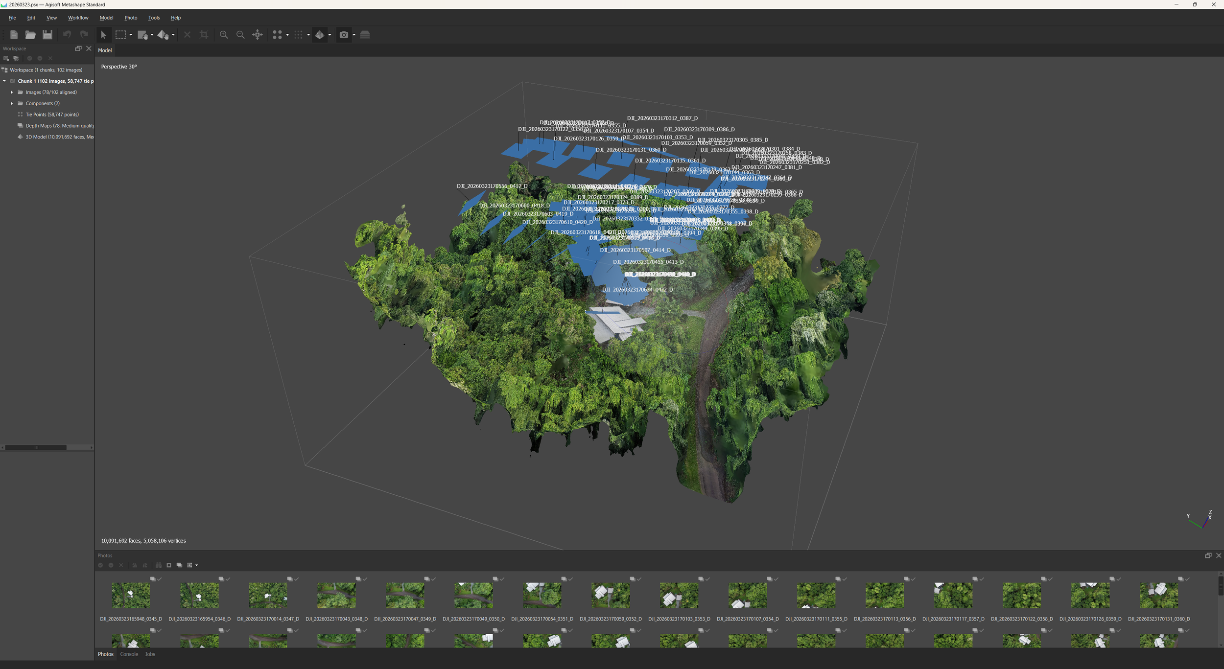
Building pads, bulk earthworks, drainage, and complex landforms.Digital Terrain Models (DTMs)
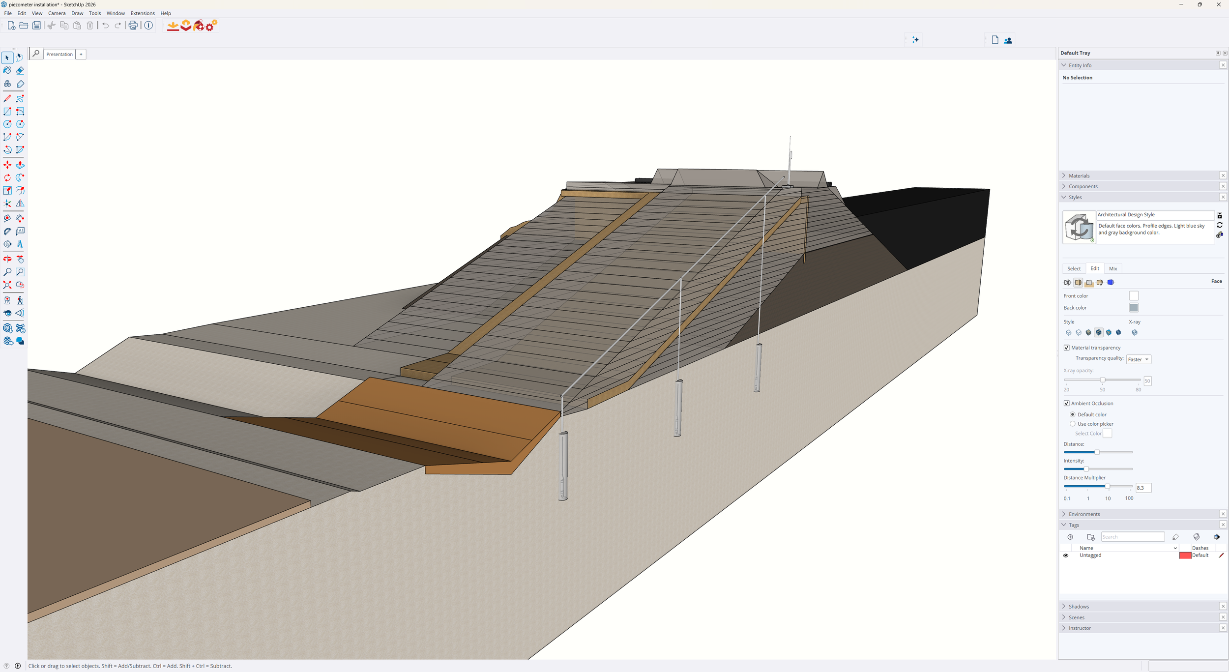
Accurate existing and design surfaces.Specialised Excavation Models
Swimming pools, septic systems, arenas, and basements.Model Conversion & Optimisation
Convert existing files into high-performance machine control formats.As-Built Modelling
Capture and document completed work with precision.
Precision You Can Trust
Using Civil 3D, 12D, Rhino, and Inventor, we produce clean, intelligent 3D models specifically optimised for Trimble Earthworks systems. Our deep understanding of both the digital and physical sides of civil earthworks ensures every model delivers maximum efficiency and accuracy on your machines.